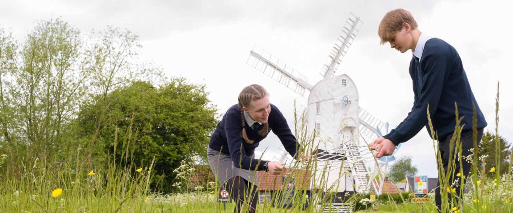
‘Geography makes a vital contribution to our knowledge of the rapidly changing environmental and social challenges facing us and how we should tackle them. A geography education has never been so relevant.’ Royal Geographical Society
The Thomas Mills High School & Sixth Form Geography curriculum aims to give pupils a broad understanding of the processes that shape the world around them and depth of geographical knowledge of people in the world and how they interact. Our topics and assessments are designed around the Geographical Associations key concepts of Place, Space, Earth systems and Environment as well as covering a range of geographical skills. This is structured to support the two key areas outlined by OFSTED:
Our Key Stage Three curriculum provides a variety of physical and human geography topics to inspire pupils to be curious about the world around them and explore enquiring questions about their surroundings. It allows them to develop a range of geographical skills and creates critical thinkers who can analyse and evaluate key concepts reaching sound substantiated conclusions and opinions.
Knowledge:
Pupils will learn to identify the difference between weather and climate. We will examine the elements of weather. They will explore the factors affecting climate and connect how this impacts climate, ecosystems and life in the UK and around the world. Pupils will explore the different rainfall types and how these impact the UK.
Skills:
Pupils will have the opportunity to learn fieldwork data collection skills and how to design an investigation. They will collect primary data using weather equipment.
Useful Links
Weather and climate: https://senecalearning.com/en-GB/revision-notes/ks3/geography/national-curriculum/5-1-1-weather-and-climate
The difference between weather and climate: https://www.bbc.co.uk/bitesize/topics/zx38q6f/articles/zqnb3j6#zbcrcmn
Royal Meteorological Society resources: https://www.metlink.org/resource/key-stage-3/
Assessments:
Weather and Climate:
Standardised Assessment 1: Raindrop story (Earth systems)
Standardised Assessment 2: Microclimate survey (Geographical skills)
Knowledge:
Pupils will learn to understand the pattern, hierarchy and function of modern day settlements and analyse the factors that were important in the past when settlements were first developed.
Pupils will apply this theory to examine urban regeneration and redevelopment of London’s Docklands in the 20th Century and analyse the key issues for London’s urban growth today. Finally, pupils will compare Rio de Janeiro to London contrasting their issues as an EDC to London as an Advanced Country world city.
Skills:
Pupils will identify settlement patterns and functions using Ordnance Survey maps and use Geographical Information Systems to explore cities.
Useful Links
What are settlements: https://www.bbc.co.uk/bitesize/articles/zrbvjhv#zbrbg7h
Mapping London resources: https://www.rgs.org/schools/resources-for-schools/mapping-london
Rio: Case study — Rio de Janeiro, Brazil – Challenges and opportunities for urban areas – OCR – GCSE Geography Revision – OCR – BBC Bitesize
Assessments:
People and Place:
Standardised Assessment 1: Location decision making exercise. (Place)
Standardised Assessment 2: People and Place end of topic test (Space)
Knowledge:
Pupils will begin by understanding the key geomorphic processes that underpin the physical geography processes of our landscapes: weathering, erosion, transportation of material, mass movement and deposition. They will take this knowledge and apply it to how it creates erosional and depositional coastal landforms. Pupils will examine the methods of coastal management available and what people think of the options.
Pupils will briefly examine how these processes differ in glacial environments and the landforms these produce.
Skills:
Pupils will use OS maps and satellite imagery to examine how coastal landscapes have changed over time and are impacted by geomorphic processes.
Useful Links
Coastal processes and landforms: Coastal processes and landforms – BBC Bitesize
Coastal processes: Coastal Processes
Range of videos for KS3 coasts https://timeforgeography.co.uk/video-collections/coasts/
Assessments:
Landscapes:
Standardised Assessment 1: Coastal processes test (Earth systems)
Standardised Assessment 2: Do Glaciers matter decision making exercise (Earth systems)
Knowledge:
This topic is designed to tackle the misconceptions pupils have about the continent of Africa. Pupils study the geography of Africa considering how the climate and relief create a vast range of ecosystems. Pupils then examine the history of Africa and how it has shaped the continent as we know it today and finally, pupils focus on Kenya; its development, diversity and culture and evaluate the influence of tourism on its development.
Skills:
For this topic pupils will work with maps at a range of scales and make connections between location and physical and human landscape features.
Useful Links
The geography of Africa: The geography of Africa – BBC Bitesize
Physical geography of Africa: https://education.nationalgeographic.org/resource/africa-physical-geography/
Physical geography of Africa: Physical Geography of Africa – Geography: KS3
Savanna Case study: Plant and animal adaptations in tropical savanna grasslands
Assessments:
Africa:
Standardised Assessment 1: Population distribution of Africa (Place)
Standardised Assessment 2: Tourism in Kenya (Place)
Knowledge:
This skills based topic allows pupils to develop a range of map skills from understanding scale and measurements, using compass directions and grid references, to analysing contour lines and applying these skills to real-life situations.
Skills:
Map reading skills
Useful Links
OS map skills: https://www.bbc.co.uk/bitesize/guides/z6j6fg8/revision/1
Ordnance Survey map skills resources: Mapzone | Ordnance Survey
Assessments:
Map skills:
Standardised Assessment 1: Harry Potter Map Skills Test (Geographical skills)
Standardised Assessment 2: Wickham Market Tourist board Assessment (Geographical skills)
Knowledge:
Pupils investigate the formation of fossil fuels and issues behind using them now and in the future. A range of renewable energy sources are examined and pupils have the chance to design their own future plans for the UK’s energy. The use of biofuels and wacky fuel alternatives are analysed. The topic concludes with a fieldwork investigation as to where on the school site a wind turbine could be placed. Pupils undertake an energy efficiency survey and an environmental impact assessment as part of their primary data collection. The results are written up and presented as a letter to the headteacher with the pupils’ recommendations.
Skills:
Primary data collection and fieldwork skills. Data analysis and report writing
Useful Links
Energy resources: Energy resources – KS3 Geography – BBC Bitesize
Range of energy activities: weve_got_the_power_activity_ks3.pdf
Renewable energy theory: Renewable Energy – Air & Ground – Science: KS3
Assessments:
Energy:
Standardised Assessment 1: Wind turbine project letter (Environment)
Standardised Assessment 2: Renewable energy invention (Environment)
Knowledge:
Pupils will explore how populations grow, change, and move. They’ll study population density, distribution, and urbanisation, and learn how these patterns vary around the world. Using the Demographic Transition Model, they’ll understand how population growth changes as countries develop. Pupils will also examine ageing and youthful populations, population policies, and international migration—looking at the causes, challenges, and impacts. To make learning interactive, they’ll take part in the Jelly Baby Game, which helps explain the key factors behind population change. These topics build global awareness and critical thinking in a fun and engaging way.
Skills:
Use maps to interpret population data
Use of population pyramids to analyse population change
Useful Links
National curriculum summary: National Curriculum – Geography key stages 3 and 4
Population and migration: Population and migration – KS3 Geography – BBC Bitesize
China population policies: How is China changing? – KS3 Geography – BBC Bitesize
Assessments:
Population:
Standardised Assessment 1: Factors affecting population change (Space)
Standardised Assessment 2: International migration-decision line task (Space)
Knowledge:
Pupils will study a range of ecosystems, focusing on their global locations, climates, and environmental importance. They’ll explore the unique features and management of polar regions and coral reefs, and examine the structure and role of the tropical rainforest. Pupils will also learn about the Yanomami people, the impact of deforestation, and take part in a rainforest development debate based on Papua New Guinea. These lessons help pupils understand the balance between environmental protection and human needs.
Skills:
Locating ecosystems on world map, understanding biome location.
Useful Links
Global biomes: Global biomes – KS3 Geography – BBC Bitesize
Savanna adaptations: Plant and animal adaptations in tropical savanna grasslands
Tropical rainforests: Tropical rainforests guide for KS3 geography students – BBC Bitesize
Yanomami tribe: Yanomami
Assessments:
Ecosystems:
Standardised Assessment 1: Animal adaptation task (Earth systems)
Standardised Assessment 2: Human impacts on coral reefs (Environment)
Knowledge:
Pupils will explore the powerful forces that shape our planet. They’ll begin by understanding the structure of the Earth and how plate tectonics cause natural events like earthquakes and volcanoes. Through real-world case studies—including the 2010 Iceland volcanic eruption, the Haiti earthquake, and Hawaii’s volcanic hotspots—pupils will investigate the causes, impacts, and responses to these dramatic events. This unit helps pupils understand the dynamic nature of Earth and how people adapt to living with natural hazards.
Skills:
Interpret plate boundary map.
Apply plate movements to world map and understand safety considerations
Active volcano hazard mapping
Useful Links
Plate tectonics theory: Plate tectonics – BBC Teach
Earthquakes and tsunamis: Tectonic hazards – earthquakes and tsunamis guide for KS3 geography students – BBC Bitesize
Haiti earthquake: 2010 Haiti earthquake | Magnitude, Damage, Map, & Facts | Britannica
Hawaii hotspots: A Chain of Islands: Hawaiian Hot Spot
Assessments:
Plate Tectonics:
Standardised Assessment 1:Haiti earthquake impacts significance essay (Environment)
Standardised Assessment 2: Plate tectonics and case study test (Earth systems and Environment)
Knowledge:
Pupils will deepen their understanding of global development by learning how we measure development and use indicators like income, education, and life expectancy to compare countries. They will examine the stages of growth in Rostow’s model and explore the development gap between richer and poorer nations. As part of their focus on the environment, students will explain how sustainable solutions—such as the Annapurna micro hydro dams in Nepal—can support local communities. They will also evaluate the role of aid in helping countries develop, considering both its benefits and limitations. This unit encourages thoughtful discussion about fairness, sustainability, and global progress.
Skills:
Locational knowledge of world’s countries and features
Useful Links
Development theory: Development – KS3 Geography – BBC Bitesize
Development and aid: Development and aid – a help or a hindrance? – Why some countries are richer than others – OCR – GCSE Geography Revision – OCR – BBC Bitesize
Micro hydro dams in Annapurna, Nepal:
Assessments:
Development:
Standardised Assessment 1: Causes of poverty decision answer (Space)
Standardised Assessment 2: Sustainability report (Environment)
Knowledge:
Pupils will identify the key stages of the water cycle and understand how rivers shape the landscape through their upper, middle, and lower courses, forming different landforms along the way. They will investigate real-life examples of flooding, including the Boscastle and Brisbane floods, using a decision-making exercise to explore how people respond to these natural events. Pupils will explain the physical processes behind flooding and evaluate different flood management techniques, considering how effective and sustainable they are. This unit helps pupils connect physical geography with human responses to environmental challenges.
Skills:
Decision making exercise. Map skills
Useful Links
River processes and landforms: Rivers are part of the water cycle. Learn about river processes and landforms in this geography guide for students aged 11 to 14 from BBC Bitesize. – BBC Bitesize
River erosion processes: River erosion processes
River transport processes: River transport processes
River management: River management guide for KS3 geography students – BBC Bitesize
Boscastle flash flood: Boscastle Floods – Met Office
Assessments:
Rivers and Flooding:
Standardised Assessment 1: Landform information sheet (Earth systems)
Standardised Assessment 2: River processes and flooding case study test (Earth systems and Environment)
Knowledge:
Pupils will identify how our climate has changed over time and understand both the natural and human causes behind these changes. They will investigate the wide-ranging impacts of climate change on people and the environment, and explain how different communities and countries are responding to these challenges. Finally, pupils will evaluate a range of solutions to climate change, considering how effective and sustainable they are. This unit encourages pupils to think critically about their role in protecting the planet and the importance of global cooperation.
Skills:
Invention task. Global issues.
Useful Links
Climate change theory: Climate change – KS3 Geography – BBC Bitesize
Natural causes of climate change: Natural causes of Quaternary climate change
Human causes of climate change: Human causes of climate change
Climate change theory: Climate change resources: Key Stage Three – RGS
Effects of climate change: Effects of Climate Change on the Environment – Geography: KS3
Assessments:
Climate Change:
Standardised Assessment 1: Impacts of climate change information sheet (Earth systems)
Standardised Assessment 2: Earthshot invention task (Environment)
‘Geography makes a vital contribution to our knowledge of the rapidly changing environmental and social challenges facing us and how we should tackle them. A geography education has never been so relevant.’ Royal Geographical Society.
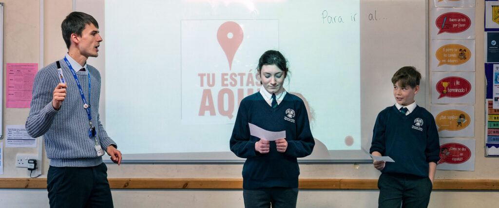
At Thomas Mills High School & Sixth Form we teach GCSE OCR B Geography: Geography for enquiring minds. We alternate between physical and human geography topics and complete two local fieldtrips to Southwold and Ipswich Waterfront. This course allows our pupils to think critically, interpret and analyse data and make sense of the world around them both natural and man-made.
OCR state their aims and learning outcomes are:
Knowledge:
This topic allows learners to develop an understanding of a variety of hazards that impact human lives both within the UK and worldwide. Earthquakes and volcanic eruptions are just some of the deadly hazards we face on Earth. Not only do they impact humans but they also shape our land. An understanding of tectonic hazards is developed; exploring the causes, consequences and responses to a tectonic event of choice.
Case studies: Haiti earthquake 2010, Iceland volcano 2010
Skills:
Map and data interpretation. Research skills.
Useful Links
Specification: OCR GCSE (9–1) in Geography B (Geography for Enquiring Minds) (J384) Specification
Seneca learning: Seneca – Learn 2x Faster
Tectonic landscapes and hazards: Tectonic landscapes and hazards – GCSE Geography – BBC Bitesize
Tectonic hazard impacts: What are the effects of tectonic hazards? – Internet Geography
Plate tectonic theory: The theory and discovery of plate tectonics
Haiti earthquake 2010: https://handygeography.wordpress.com/gcse/the-restless-earth-revision-materials/earthquake-case-study-haiti-poor/
Iceland volcano case study: Eyjafjallajokull Case Study – Internet Geography
Assessments:
One of the key challenges at GCSE is accessing and decoding the exam language and command words. Regular application of content to exam questions is key for building confidence and success at GCSE.
Assessment 1: Tectonic plates and boundaries exam practice short answer questions set as a homework (19 marks)
Assessment 2: Earthquakes short answer questions completed in class and essay on Haiti earthquake as homework (32 marks)
Assessment 3: End of topic test using past exam questions. In class in exam conditions.(33 marks)
Knowledge:
We live in an unequal world, where the gap between prosperity and poverty is widening. This topic asks learners to consider the changing nature and distribution of countries along the development spectrum before examining the complex causes of uneven development. The future for Low Income Developing Countries (LIDCs) is uncertain and will be investigated through an in-depth study of one country, considering its development journey so far, how its global connections may influence the future and possible alternative development strategies.
Case study: Democratic Republic of the Congo.
Skills:
To understand the barriers to development for an LIDC and examine how they can be inter-related.
Useful Links
Specification: OCR GCSE (9–1) in Geography B (Geography for Enquiring Minds) (J384) Specification
Seneca learning: Seneca – Learn 2x Faster
Theories of development: Theories of development – RGS
Democratic Republic of the Congo Case Study: D.R.Congo – an LDC
Assessments:
Assessment 1: Factors affecting development short answer exam questions (20 marks). Homework task.
Assessment 2: Increasing development-stages and goals. Short answer exam questions completed in class and practice essay as homework task (17 marks).
Assessment 3: End of topic test (25 marks). In class in exam conditions.
Knowledge:
The UK contains a diverse and distinct range of landscapes. This topic gives learners the opportunity to unravel the geographical processes that make them distinctive. A deeper understanding of the geomorphic processes that shape river and coastal landscapes and consideration of the human influence on these is developed.
Case studies: Purbeck coast, Dorset. River Thames.
Fieldwork: How does hard engineering shape the coast at Southwold?
Skills:
Application of processes to UK case study examples. Map and data interpretation. Evaluation of human activities in physical landscapes.
Useful Links
Specification: OCR GCSE (9–1) in Geography B (Geography for Enquiring Minds) (J384) Specification
Seneca learning: Seneca – Learn 2x Faster
Physical geography of the UK: Physical Geography of the UK – UK Landscapes – Internet Geography
Distinctive landscapes: Physical landscapes in the UK – Distinctive landscapes in the UK – OCR – GCSE Geography Revision – OCR – BBC Bitesize
Coastal management: Coastal Management – Field Studies Council
Purbeck coast Case Study: Dorset Coast – Internet Geography
River processes: River profiles – River processes – OCR – GCSE Geography Revision – OCR – BBC Bitesize
River landforms: Erosional landforms – River landforms – OCR – GCSE Geography Revision – OCR – BBC Bitesize
River Thames case study: Distinctive Landscapes- River Thames case study Flashcards | Quizlet
Assessments:
Assessment 1: UK landscape (16 marks). Short answer exam questions as homework task.
Assessment 2: Coastal landscapes (19 marks). Short answer questions in class and essay on Dorset coast for homework.
Assessment 3: River landforms short answer exam questions (22 marks). Homework task.
Assessment 4: UK river landscapes short answer exam questions and River Thames essay. Short answer in class and essay for homework.
Assessment 5: Distinctive landscapes end of topic test using past exam questions (49 marks). Exam conditions.
Assessment 6: Physical fieldwork exam questions on Southwold fieldtrip (22 marks). Homework task.
Knowledge:
This topic allows learners to develop an understanding of a variety of hazards that impact human lives both within the UK and worldwide. Learners investigate how weather can be hazardous, gaining knowledge of the major processes within the atmosphere and their impact in creating extreme weather. This is contextualised through two case studies of natural weather hazard events.
Case studies: Boscastle flash flood 2004 and Australia Big Dry 2002-2009.
Skills:
Map and data interpretation. Research skills.
Useful Links
Specification: OCR GCSE (9–1) in Geography B (Geography for Enquiring Minds) (J384) Specification
Seneca learning: Seneca – Learn 2x Faster
Australia Big Dry Case study: The impact of drought in Australia – Droughts – OCR – GCSE Geography Revision – OCR – BBC Bitesize
Boscastle Flash Flood: Boscastle Floods – Met Office
Assessments:
One of the key challenges at GCSE is accessing and decoding the exam language and command words. Regular application of content to exam questions is key for building confidence and success at GCSE.
Assessment 1: Global atmospheric circulation and extreme weather (16 marks). Homework task.
Assessment 2: Tropical storms (23 marks). Homework task.
Assessment 3: Atmospheric hazards end of topic test (37 marks). In class in exam conditions.
Knowledge:
Supplies of food, energy and water are three of the most challenging issues the world faces. Significant numbers of people are resource poor, whilst others consume more than their fair share. This topic investigates emerging patterns, where demand is outstripping supply, exploring the issue of food security and considering the question ‘can we feed nine billion people?’. Learners will investigate what it means to be food secure, how countries try to achieve this and reflect upon the sustainability of strategies to increase food security.
Case studies: Tanzania food security data. Past attempt of food security in Tanzania-Canada Wheat Programme. Present attempt of food security in Tanzania-Southern Agricultural Growth Corridor of Tanzania (SAGCOT) and local example of food security in Tanzania- Goat aid.
Skills:
Data analysis and interpretation. Research skills.
Useful Links
Specification: OCR GCSE (9–1) in Geography B (Geography for Enquiring Minds) (J384) Specification
Seneca learning: Seneca – Learn 2x Faster
Local scale case study: Goat Aid in Tanzania Food Security and Affecting Factors
Tanzania Case Studies: Resource Reliance: Case studies of attempts to achieve food security in Tanzania
Assessments:
Assessment 1: Human use of the environment (19 marks). Homework task.
Assessment 2: Food security and access to food (17 marks). Homework task.
Assessment 3: End of topic test (36 marks) in class exam conditions.
Knowledge:
Never before has the landscape of the planet looked more urban. Cities are growing at unprecedented rates. This topic seeks to explore why, and consider how the global pattern of urbanisation is changing. Urban challenges and opportunities are varied and unique and learners will examine these through studying two cities, one from an advanced country (AC) and one from either an emerging and developing country (EDC) or a low-income developing country (LIDC). Within each city, contrasting ways of life, geographical processes, problems and solutions will be studied to gain a holistic understanding of what makes up the urban fabric of each place.
Case studies: London and Rio de Janeiro
Skills:
Source interpretation. Critical thinking and comparative writing.
Useful Links
Specification: OCR GCSE (9–1) in Geography B (Geography for Enquiring Minds) (J384) Specification
Seneca learning: Seneca – Learn 2x Faster
London case Study: A City in the UK – London Case Study – Internet Geography
London Case Study – Latitude Geography
Rio Case Study: Case study – Rio de Janeiro, Brazil – Challenges and opportunities for urban areas – OCR – GCSE Geography Revision – OCR – BBC Bitesize
Case Study Rio de Janeiro – Internet Geography
Assessments:
Assessment 1: Urban growth theory (20 marks). Homework task.
Assessment 2: Urban processes (22 marks). Homework task.
Assessment 3: Cities in developing countries (21 marks). Short answer questions in lesson. Essay planned and completed for homework.
Assessment 4: End of topic test (40 marks). In class, in exam conditions.
Knowledge:
Climate change is one of the most controversial global issues of the 21st century. In this topic learners will analyse patterns of climate change from the start of the Quaternary period to the present day, considering the reliability of a range of evidence for the changes. Learners will study the theories relating to natural climate change and consider the influence of humans on the greenhouse effect. Social, economic and environmental impacts of climate change at both local and global scales will be examined.
Case studies: UK impacts of climate change.
Worldwide impacts including Brazilian drought, Portuguese wildfires and sea level rise in Tuvalu.
Skills:
Cartographic and graphical analysis:
extract, interpret, analyse and evaluate information.
Select and construct appropriate graphs and charts, using appropriate scales and annotations to present information. Effectively present and communicate data through graphs and charts.
Useful Links
Specification: OCR GCSE (9–1) in Geography B (Geography for Enquiring Minds) (J384) Specification
Seneca: Seneca – Learn 2x Faster
Climate change summary: What is climate change? – Internet Geography
Natural causes of climate change: Natural causes of Quaternary climate change
Human causes of climate change: Human causes of climate change
Tuvalu case study: Tuvalu: Why Is the Small Island Nation Sinking? | Earth.Org
South America drought: Intense, Widespread Drought Grips South America
Assessments:
Assessment 1: Climate change evidence and causes (20 marks). Homework task.
Assessment 2: Climate Change end of topic test (37 marks). In class exam conditions.
Knowledge:
A diverse range of cultures, identities and economies make up the patchwork of the UK. This topic poses questions about the changing nature of people’s lives and work in the UK in the 21st century. It asks learners to consider some of the drivers for this change. As new economic superpowers emerge, questions have been posed about the global significance of the UK. This will be investigated through a study of the UK’s political and cultural connections with the rest of the world.
Case studies:
Skills:
Data analysis, synoptic links, problem solving. Formulating enquiry and argument using a variety of sources
Useful Links
Specification: OCR GCSE (9–1) in Geography B (Geography for Enquiring Minds) (J384) Specification
Seneca: Seneca – Learn 2x Faster
Ageing population: The ageing population of the UK – Population change and movement to the UK – Eduqas – GCSE Geography Revision – Eduqas – BBC Bitesize
Population growth in London: The Growth of London – Internet Geography
Cambridge Science Park Case Study: Cambridge Science Park – Building a better world
Uks role in Somalia conflict: UK’s Role in Conflict in Somalia (UK in the 21st Century Case Study) Flashcards | Quizlet
Assessments:
Assessment 1: Characteristics and population of UK (16 marks). Homework task.
Assessment 2: UK’s role in the world and UK media (20 marks). Short answer in class and essay plan. Essay for homework.
Assessment 3: UK in the 21st Century end of topic test (33 marks). In class-exam conditions.
Knowledge:
Life on Earth is supported by global ecosystems and the link between human wellbeing and ecosystem wellbeing is vital. This topic explores the distribution and characteristics of the Earth’s ecological wonders. Learners investigate the two contrasting ecosystems of tropical rainforests and polar environments, exploring physical cycles and processes that make these ecosystems distinctive, the threats posed to their existence and how humans are attempting to manage them for a more sustainable future.
Case studies: Samasati Nature Retreat, Costa Rica. Small scale management-whaling in the Arctic. Global actions in the Arctic-international protocols.
Skills:
Cartographic and graphical analysis
Suggest improvements to, issues with or reasons for using maps , graphs, statistical techniques and visual sources, such as photographs and diagrams.
Useful Links
Specification: OCR GCSE (9–1) in Geography B (Geography for Enquiring Minds) (J384) Specification
Seneca: Seneca – Learn 2x Faster
Sustaining ecosystems: Sustaining environments – GCSE Geography – BBC Bitesize
What is an ecosystem?: What is an ecosystem? – Ecosystems – OCR – GCSE Geography Revision – OCR – BBC Bitesize
Samasati nature retreat: Costa Rica Retreat & Wellness Center | Yoga & Meditation
Arctic whaling: Arctic Whaling: A Historic Synopsis | Poseidon Expeditions polar cruises
Assessments:
Assessment 1: Global ecosystems (18 marks). Homework task.
Assessment 2: Tropical rainforests human impacts. Short answer in class. Essay at home.
Assessment 3: End of topic test (67 marks) In class-exam conditions.
Understanding the world around you? Making sense of the processes that shape our planet? Analysing how hazards change our lives; interpreting trade & migration statistics? Making sense of what we see and hear in the news about geopolitics around the world? Evaluating the past, present and future plans for global climate change? Investigating your own geographical topic in the local area?
Development, environment, travel & tourism, geoscience, weather, mapping, planning, risk management, conservation & wildlife, teaching and many more.
Mrs Esworthy